
Brevard County Property Appraiser Map BCPAO Map Search: Simple 2026 Guide to Interactive Maps & Parcel Viewing
Hi, I’m Raj Patel from BrevardCountyPropertyAppraiser.us.
After 18 years guiding Florida residents on property tools, this guide focuses on the BCPAO map features—especially the interactive MapView (also called map search).
I checked the official site bcpao.us today (February 23, 2026), tested the maps, and included real steps with tips from locals in Titusville, Viera, Melbourne, Palm Bay, Cocoa Beach, and Merritt Island.
This is your free way to see parcels, boundaries, aerial photos, sales, roads, and more—perfect for checking flood zones, zoning, property lines, or researching buys/sales in Brevard.
The main tool is MapView (interactive web map at bcpao.us/map). There’s also EagleView for oblique aerials, downloadable GIS data at bcpao.us/PublicData.aspx, and section/plat maps.
Real Example: A Viera buyer used MapView to click their parcel, view recent aerials, measure lot size, and confirm no conservation overlay—helped them negotiate $5,000 off the price.
Step-by-Step: How to Use BCPAO Map Search (MapView) in 2026
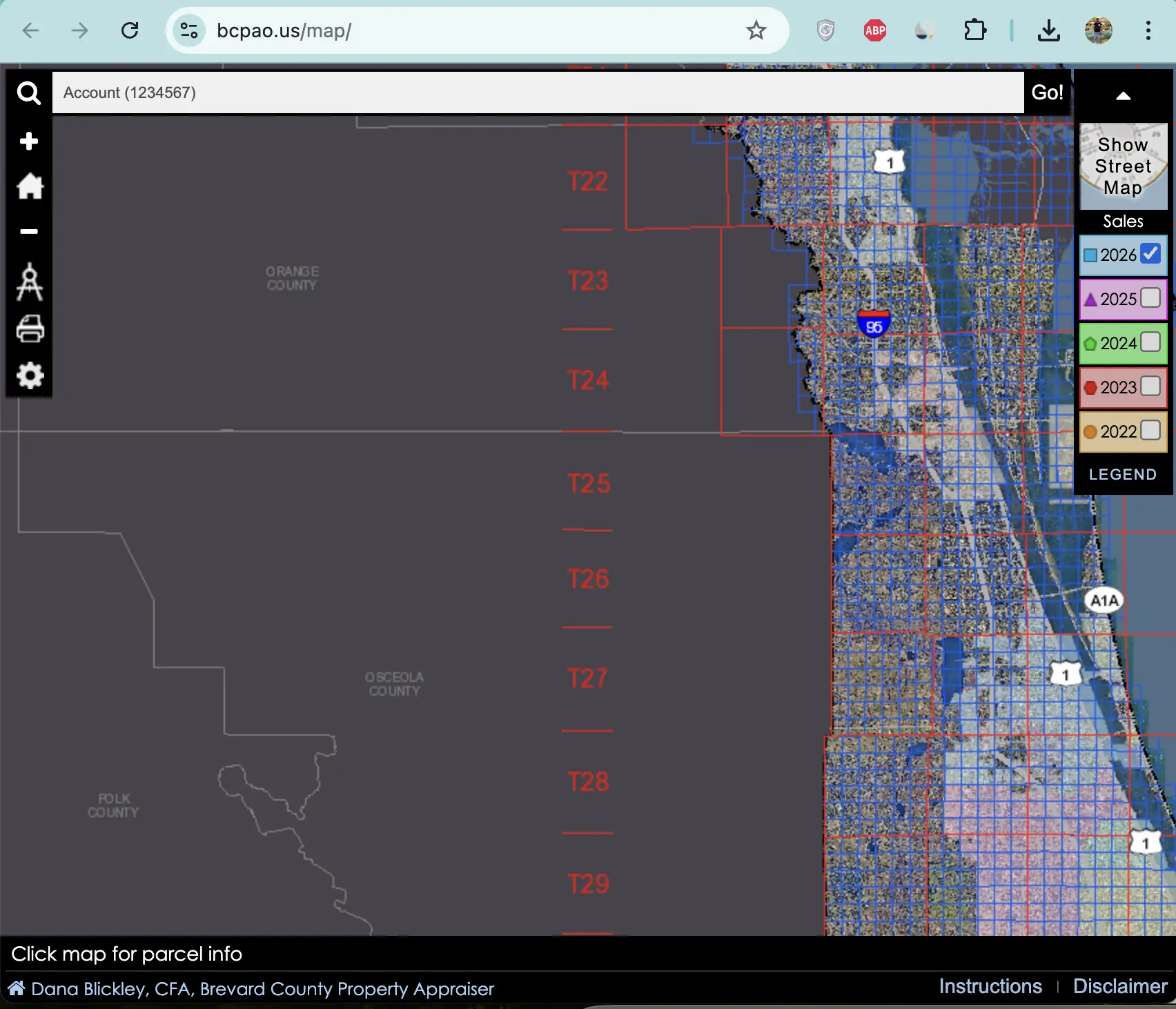
- Go to the interactive map: Open bcpao.us/map in your browser (works on phone or computer—no app needed).
- Wait for the map to load: It shows Brevard County overview with parcels, roads, water, and aerial base layer.
- Zoom and pan to your area:
- Use mouse wheel or +/− buttons to zoom in/out.
- Click and drag to pan/move around.
- Quick buttons: “Zoom to Brevard County” or search for your city (e.g., “Melbourne”).
- Search for a property:
- Click the Quick Search or search box (top or side panel).
- Type address, parcel ID, owner name, or keywords (e.g., “123 Rocket Ln Titusville”).
- Hit enter—map zooms to matching parcels (blue outline highlights).
- If multiple matches, pick from list.
- Click a parcel on the map:
- Parcel highlights with info pop-up: owner, address, parcel ID, value summary (market/assessed/taxable), exemptions, sales history.
- Click “Details” for full record (links to property search page).
- Options: “Zoom” closer, “Clear” highlight, “EagleView” for oblique photos, “Hide Info”.
- Turn on layers and tools:
- Open Settings Panel (gear icon or side button).
- Toggle layers: Aerial (photos), Sales (color-coded by date/price), Parcels, Roads, Water, Township/Range grid, Land use.
- Open Measure Tools: Click to measure distance/area (e.g., lot size in feet/acres).
- Make a Map: Save/print custom view with layers.
- View aerials and advanced views:
- Switch to Aerial Map (button or layer).
- For oblique (angled) photos: Click “EagleView” on parcel → opens viewer with North/South/East/West views, image dates, zoom/pan.
- Rotate compass arrows or click directions to change angle.
- Explore extras:
- Sales Legend: See color codes for recent sales.
- Condo zoom: Click condo icon for unit details.
- Print: Use browser print or “Make a Map” tool.
- Save or export:
- Screenshot for records.
- For advanced: Download GIS files from bcpao.us/PublicData.aspx (see below).
Extra Practical Tips & Fixes
- Slow load? Use desktop for best speed; clear browser cache.
- No parcel found? Zoom in more or search by address/parcel ID first.
- Mobile tips: Pinch to zoom; tap parcels for info.
- Flood/zoning check: Turn on water layers + parcels—great for Merritt Island or coastal areas.
- Hack: Click “Instructions” link on map for full PDF guide (covers pan/zoom, layers, printing).
- Video help: Watch BCPAO’s MapView tutorial on YouTube (search “BCPAO MapView” or check bcpao.us/Tutorials.aspx).
- Advanced users: Download free GIS data at bcpao.us/PublicData.aspx:
- Parcels.zip (48 MB, Feb 18, 2026) — shapefile for boundaries.
- Basemap_gdb.zip (43 MB) — cities, sections, subdivisions.
- Reference_gdb.zip (116 MB) — roads, water, centroids.
- Open in free tools like QGIS or ArcGIS viewer (links on page).
- Aerials: Paid ECW files ($10 per township block or $350 countywide).
Quick Help if Needed
- Call BCPAO: (321) 264-6700 — ask for map/GIS help.
- Email: gis.services@bcpao.us for data questions.
- Visit offices: Titusville (400 South St), Viera (2725 Judge Fran Jamieson Way), Melbourne (1515 Sarno Rd), Palm Bay (450 Cogan Dr SE) — Mon-Fri 8 AM-5 PM.
This map tool is powerful and free—use it to explore Brevard parcels like a pro. Bookmark bcpao.us/map!
Questions? Contact BCPAO or me. Happy mapping on the Space Coast!
— Raj Patel Florida Property Maps & Tax Expert BrevardCountyPropertyAppraiser.us